Galapagos - The Ultimate Ecological Experience - March 29-April 5, 2024
Join Gabriel on a journey to the first UNESCO World Heritage Site, famed destination of Darwin, home to unique flora & fauna found nowhere else - the trip of a lifetime!
-
Arrive in Guayaquil. We will gather at our hotel in Guayaquil and meet our Ecuadorian guide Roberto Cedeño; depending on everyone’s arrival time we may do a bit of birding in a local park such as the Parque Historico Guayaquil, or explore the famous Malecon. Dinner & night in Guayaquil.
-
AM: FLIGHT TO GALAPAGOS
We will fly from Guayaquil to the Galapagos Islands to begin our adventure.
Once in Santa Cruz, passengers must go through an inspection point at the airport to make sure that no foreign plants or animals are being introduced to the archipelago.
Santa Cruz offers excellent opportunities to observe the wild Galapagos Giant Tortoises. Tracking tortoises is not the only exciting activity to be found in the highlands. There are also plenty of lava tubes, sinkholes and craters ready to be explored.
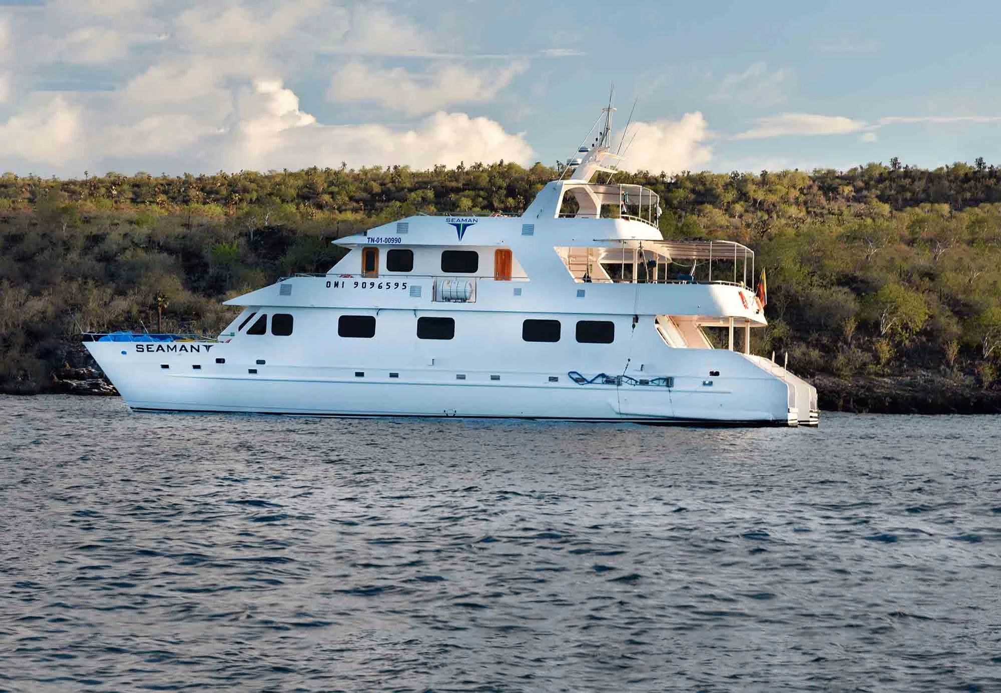
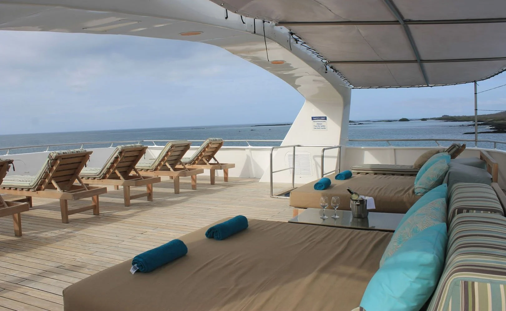
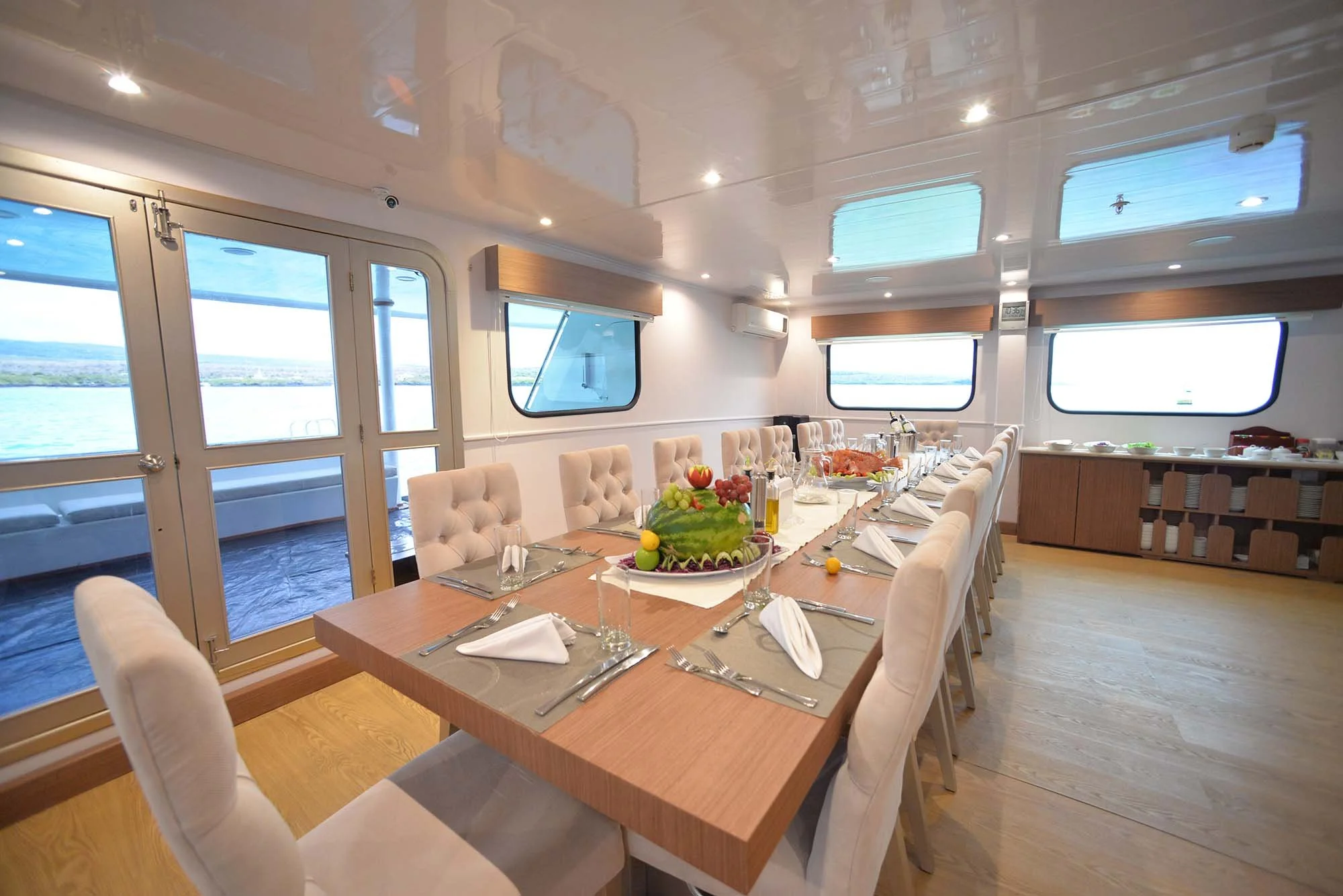
Our local guide will pick us up and carry our luggage to the bus that transports tourists to the ferries to cross the Itabaca Channel. After this, we will be taken by another bus to visit Rancho Manzanillo. The visit to Rancho Manzanillo includes a picnic lunch and a short walk before boarding our beautiful Motor Catamaran, our home for the next week.
-
AM: FERNANDINA ISLAND, MANGLE POINT
Off the eastern coast of Fernandina, Mangle Point can be found, a superior snorkeling site and a beautiful location for riding in a zodiac through the groves of mangrove trees. While we are on our ride, we are likely to see sea lions, giant tortoises, rays and more. Birds could include both Magnificent and Great Frigatebird, Blue-footed Booby, Galapagos Hawk, Galapagos Flycatcher, Galapagos Martin, Galapagos Mockingbird, and more.
PM: PUNTA MORENO
Punta Moreno is located on the north coast of Isabela Island between the volcanoes of Sierra Negra and Cerro Azul.
The trail runs along a lava flow Pahoehoe (solidified lava in a corrugated form like an accordion) into a complex of coastal lagoons, where many coastal birds can be found, including the famous Galapagos Penguin (the most northerly penguin in the world) and the fascinating Galapagos Flightless Cormorant.
-
AM: ISABELA ISLAND, URBINA BAY
Urbina Bay is located at the base of Alcedo Volcano on the west coast, between Tagus Cove and Elizabeth Bay. This area experienced a major uplift in 1954, which caused the land to rise over 16 feet. The coast expanded half a mile out, leaving marine life stranded on the new shore. This area is also a great place to snorkel. Urbina Bay is a path that starts off with a wet landing. The course is approximately 3200m, and made up of sand, pumice, lava, coral and vegetation where one can observe iguana burrows. It is an ideal place to see red & blue lobster.
In Bahia Urbina you can see up to ten species of Darwin's Finches! Its other main attraction are the Giant Land Iguanas and Galapagos Tortoises. A large diversity of interesting vegetation can be observed such as chamomile and rosewood, but among all these plants, the beautiful flowers of Darwin’s Cotton, endemic to the Galapagos Islands, stand out.
PM: ISABELA ISLAND, TAGUS COVE
Tagus Cove is located west of Darwin Volcano on Isabela Island. This was a favorite spot for pirates and whalers, and it was them who started the following tradition: the inscription of the names of boats. At the beginning of the trail, you will see a small cave where you will find inscriptions dating to the 1800s. We will also look for the rare & local Galapagos Dove here.
Due to former eruptions, the substrate has a large amount of volcanic rocks of different sizes, among the most common are little balls of nearly spherical shape known as the "lapilli" or petrified rain.
We will also look for the beautiful but endangered Brujo Flycatcher here and at other sites.
-
AM: FERNANDINA ISLAND, ESPINOZA POINT
Espinoza Point is famous for its large colonies of Marine Iguanas and as the habitat for other unique species like the Galapagos Flightless Cormorant, Galapagos Penguin, Galapagos Hawk, and Galapagos Snake.
PM: VICENTE ROCA POINT
One of the most impressive and spectacular places of the enchanted Galapagos Islands is Punta Vicente Roca; with high cliffs and tuffstone, ash and lava formations that give this area a majestic touch . It is located in the north-western coast of the island and comprises two distinct islets. This large bay also has spectacular marine life.
Here, you can see seahorses, sea turtles and the strange yet fascinating mola-mola or giant sunfish. This bay is a great place to take a panga ride and go snorkeling with the local sea lions.
-
AM: SANTIAGO ISLAND, PLAYA ESPUMILLA
Espumilla beach is located on the northern coast of Santiago Island in James Bay. During the last presence of the El Niño phenomenon, one of the two lagoons in this site underwent a process of sedimentation, thus causing the disappearance of a representative colony of flamingos. The main attractions are the palosanto forest and the nesting of sea turtles.
PM: PUERTO EGAS
Its black beach is located on the west side of the island and is the main attraction of the island. Their volcanic tuff deposits have favored the formation of this special black sand beach.
This site is called Puerto Egas, here there was an attempt to start the exploitation of salt, which failed because the price of salt in the continent was very cheap, and did not justify its exploitation in Galapagos. The project and the infrastructure was left abandoned. We will explore the area and look for seabirds such as Galapagos Shearwater, Lava Gull, Swallow-tailed Gull, Brown Noddy, and more. We may also spot the hard-to-find Sharp-beaked Ground-Finch.
-
AM: RÁBIDA ISLAND
Rábida Island is unique due to the red color of its rocks and sand. The volcanic material in this island is very porous and external factors as rain, salty water, and sea breeze have acted as an oxidizing agent.
A short walk along a trail leads us to a coastal lagoon behind the beach which permits us to observe the land birds such as finches, doves, yellow warblers, and mockingbirds. At the lagoon there is a colony of American Flamingos - the rarer Chilean Flamingo is possible as well.
PM: SOMBREO CHINO
This is a small islet (1 sq km) located just off the southeastern tip of Santiago Island. It is a recent volcanic cone, shaped like a Chinese hat when seen from the north. On the west you can see lava formations, formed under the sea and raised upwards, this is why coral heads are found on the lava.
This is an excellent visit for interpretation of geological features such as lava tubes and lava flows. The landscape is covered by Galapagos Sea Lions, Marine Iguanas, and Galapagos Penguins. Seabirds such as Blue-footed Boobies, Nazca Boobies, and Red-footed Boobies also gather here.
-
AM: SANTIAGO ISLAND, SULLIVAN BAY
Santiago, also called James, or San Salvador Island, is located in the west central part of the Galapagos archipelago. It is the fourth largest island in the archipelago (following Isabela, Fernandina and Santa Cruz). Along with some of the large western volcanoes of Isabela and Fernandina, Santiago is also volcanically active, with many young lava flows and cones to be seen, particularly along the south, west, and east coasts.
A number of historic eruptions have been reported over the last 2 centuries. Santiago actually consists of two coalesced volcanoes: a typical shield volcano on the northwest end and a low, linear fissure volcano on the southeast end.
PM: BARTOLOME ISLAND
Bartolome Island is situated across Sullivan Bay. It has an altitude of 114 meters , from which we can observe the most beautiful scenery of the Galapagos Islands such as: Volcanic cones, lunar-like craters, lava fields, and the famous Toba formed pinnacle eroded by the sea. There is very little vegetation on this island.
It has two breathtaking beaches and at the base of the pinnacle AM: SANTIAGO ISLAND, SULLIVAN BAY
Santiago, also called James, or San Salvador Island, is located in the west central part of the Galapagos archipelago. It is the fourth largest island in the archipelago (following Isabela, Fernandina and Santa Cruz). Along with some of the large western volcanoes of Isabela and Fernandina, Santiago is also volcanically active, with many young flows and cones to be seen, particularly along the south, west, and east coasts.
These may even be seen from the summit of Darwin Volcano and from space. A number of historic eruptions have been reported over the last 2 centuries. Santiago actually consists of two coalesced volcanoes: a typical shield volcano on the northwest end and a low, linear fissure volcano on the southeast end.
PM: BARTOLOME ISLAND
Bartolome Island is situated across Sullivan Bay. It has an altitude of 114 meters , from where we can observe one of the most beautiful sceneries of the Galapagos Islands such as: Volcanic cones, lunar - like craters, lava fields, and the famous Toba formed pinnacle eroded by the sea. There is very little vegetation on this island.
It has two breathtaking beaches at the base of the pinnacle where sea turtles like to gather, as well as a small colony of Galapagos penguins.
-
AM: BACHAS ISLAND, SANTA CRUZ
These two small beaches are found to the West of Turtle Cove. Their sand is made of decomposed coral, which makes it white and soft, making it a favorite nesting site for sea turtles. Behind one of the beaches there is a small brackish water lagoon, where it is occasionally possible to observe flamingos and other coastal birds, such as Black-necked Stilts and Whimbrels.
The other beach is longer, but it has two old barges that were abandoned during the Second World War, when the USA used Baltra Island as a strategic point to protect the Panama Canal.
After the morning excursion you will be taken to the airport for your flight to the mainland. From there you can make connecting flights in the afternoon or evening, or continue with the optional 3-day mainland extension.